Maps, Routes & Dive Sites

Apple, the Apple logo, iPod, and iTunes are trademarks of Apple Inc., registered in the U.S. and other countries. iPhone is a trademark of Apple Inc.
iTunes is for legal or rightholder-authorized copying only. Don’t steal music.
Dive Log
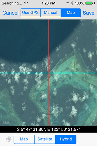
Dive Site coordinates can be entered 3 different ways:
- manually
- via the iOS devices builtin location services (including hardware GPS on most iPhones and iPad’s with WiFi+cellular)
- or by directly locating the site on a map
Be sure to take Dive Log with you to the dive site so that you can capture all the site information.
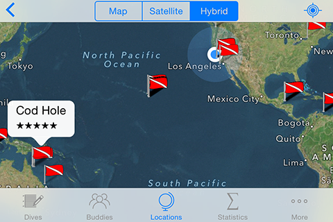
Routing
You can request routing information to the site by tapping the disclosure icon on the right hand side of the information bubble for the selected location. The option of using the built in Maps application is always available. You may also be able to get directions via a turn-by-turn navigation application if you have a TomTom or or a NAVIGON MobileNavigator version installed on your device. Note that TomTom and MobileNavigator may not be able to determine a route depending on which edition you have installed, your current location or the dive site’s location (MobileNavigator and TomTom do not provide marine navigation for example).
We will add support for other popular other 3rd party navigation applications as the necessary interfaces become available.
We will add support for other popular other 3rd party navigation applications as the necessary interfaces become available.